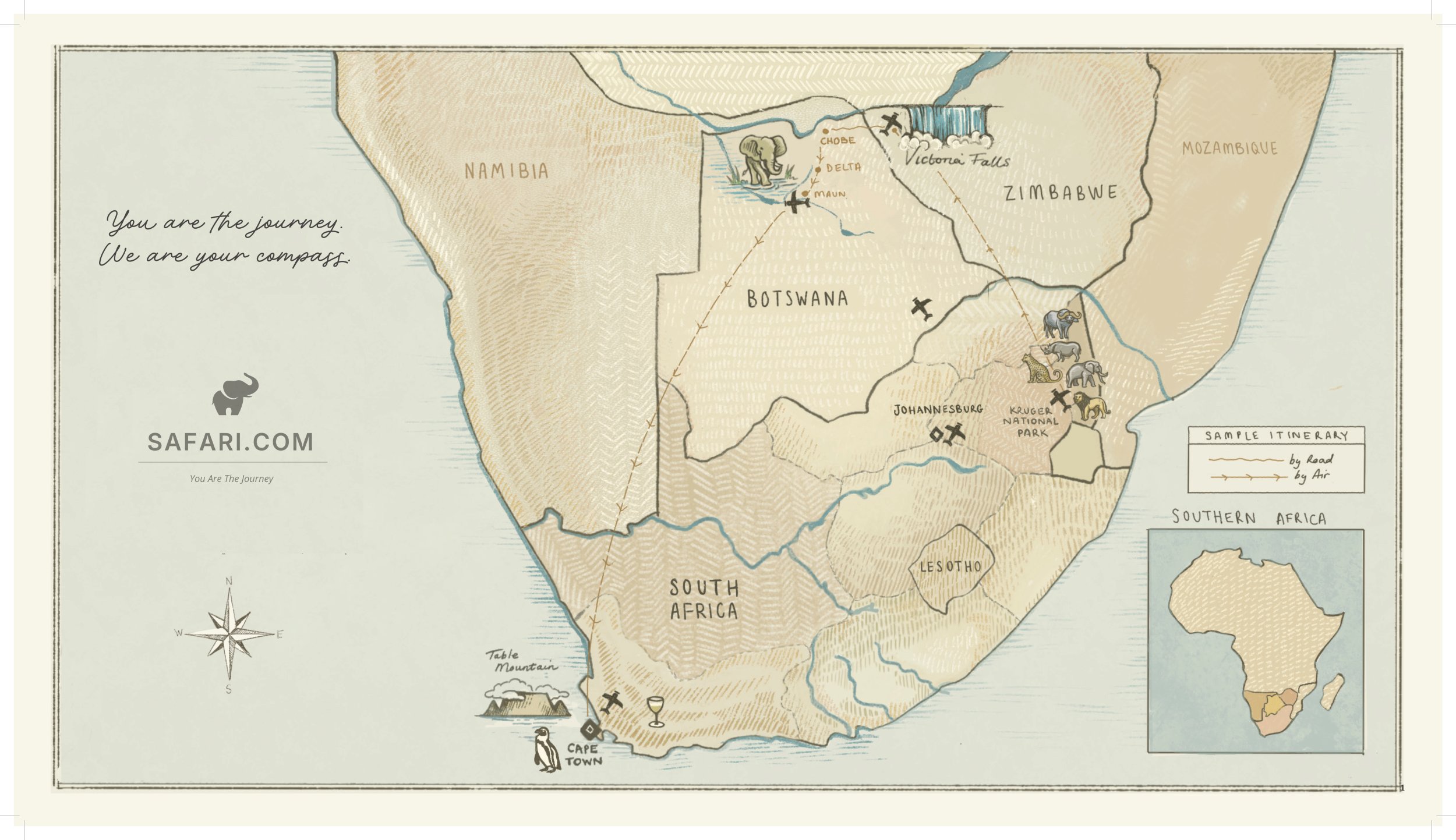
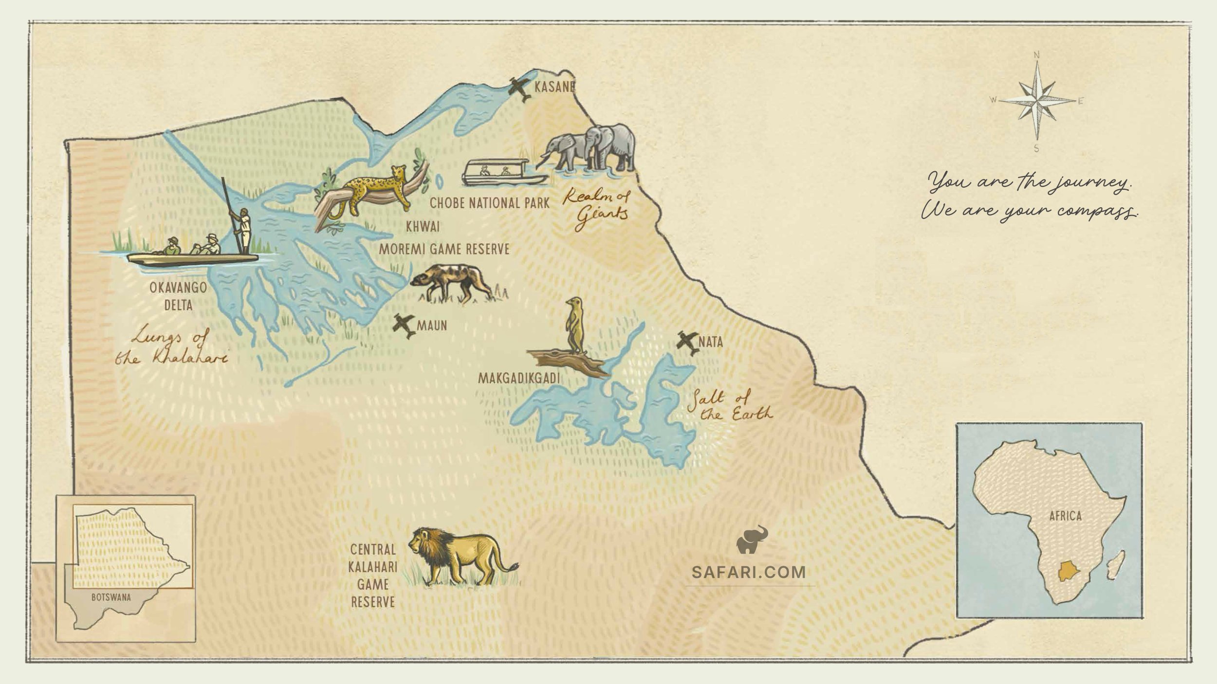
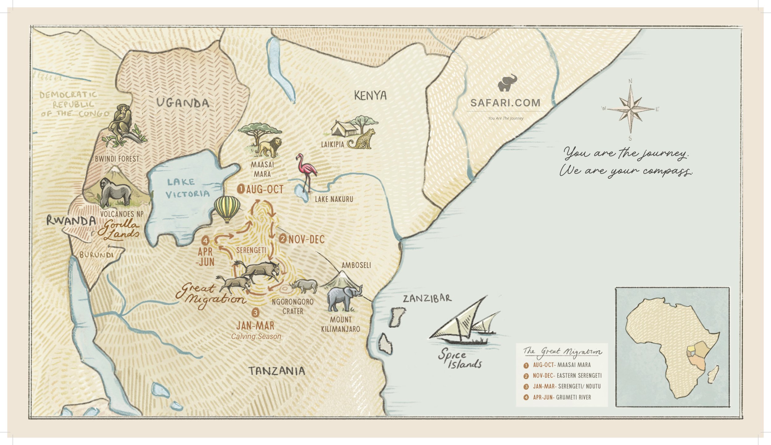
Reference map
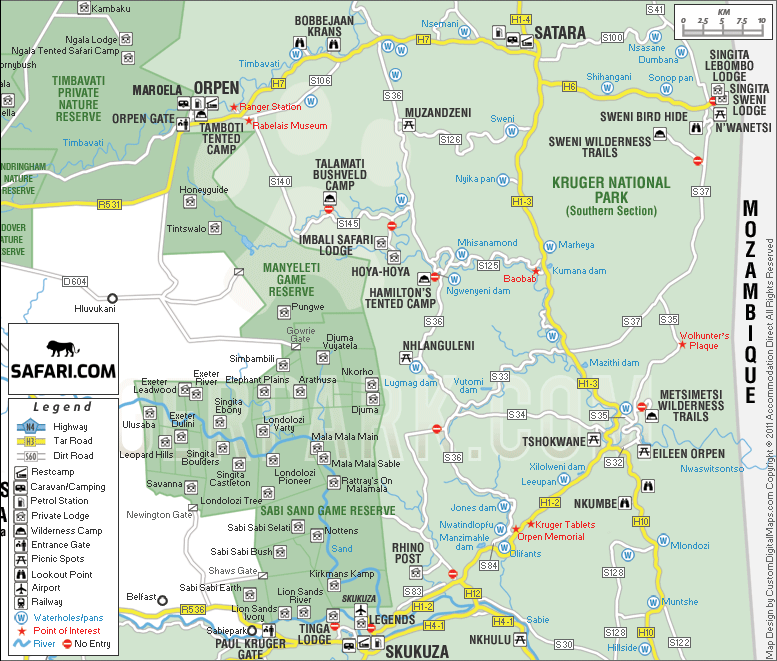
Full map of Kruger National Park and Surrounds
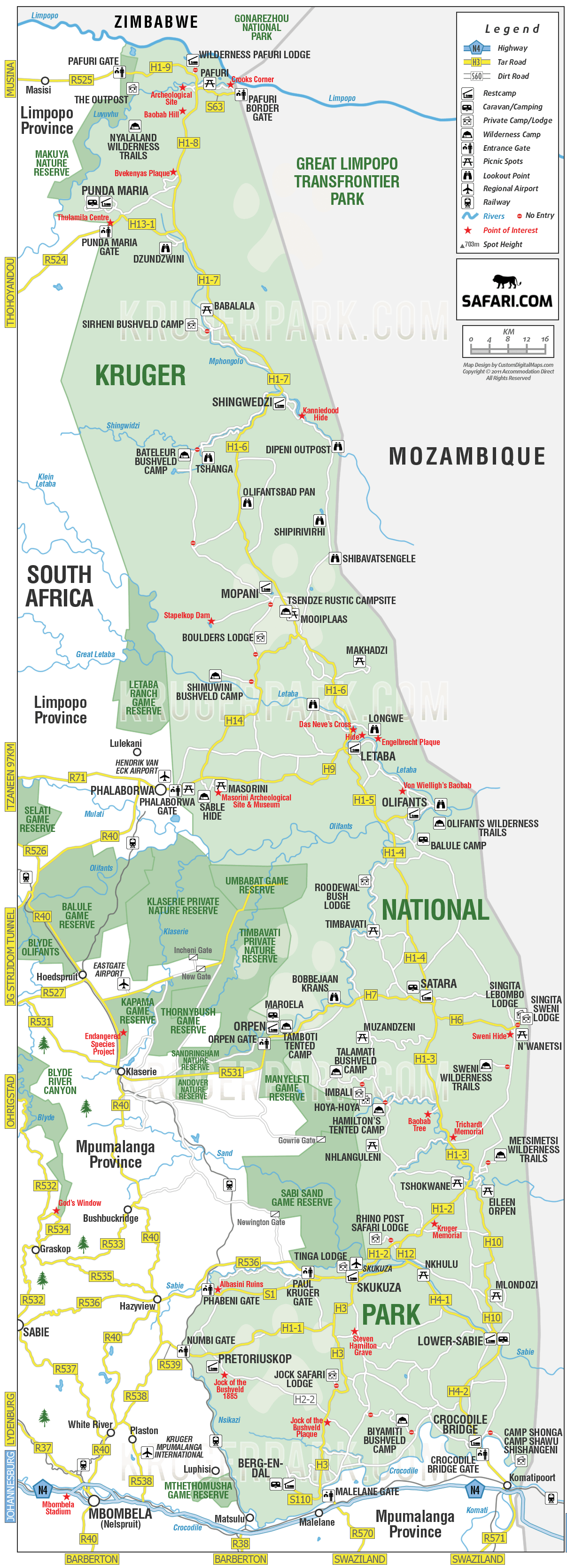
The map below illustrates the 19,485 square kilometers encompassing the Kruger National Park and its neighboring regions. It highlights all 24 self-catering SANParks rest camps/campsites, along with several private luxury lodges. Additionally, it shows the main roads and key rivers that traverse the park. Various attractions and significant landmarks are also marked—refer to the legend for details on picnic areas, lookout points, private camps, and restricted roads. You are welcome to use these maps on your website, but please ensure you credit safari.com with a link.
Free to use on your website with a credit and link back to safari.com.
Greater Kruger Park
- Kapama Game Reserve
- Klaserie Private Nature Reserve
- Manyeleti Game Reserve
- Sabi Sands Game Reserve
- Thornybush Game Reserve
- Timbavati Private Game Reserve
- Dulini Collection
- Sabi Sabi Game Reserve
- Mala Mala Game Reserve
- Lion Sands Game Reserve
- Ulusaba Game Reserve
Lodges
- Camp Shawu
- Camp Shonga
- Hamilton's Tented Camp
- Hoyo Hoyo Lodge
- Jock Safari Lodge
- Imbali Lodge
- Rhino Post Safari Lodge
- Shishangeni
- Singita Lebombo Lodge
- Singita Sweni Lodge
- Tinga Lodge (Lion Sands)
- Kruger Shalati The Train on The Bridge
- Lukimbi Safari Lodge
- Fitzpatrick's Lodge at Jock
Countries
Plan a trip
Speak to a safari specialist.
We can build a tailor-made itinerary across any of the regions on this map, at the same rates as booking direct, with a single named safari specialist from first enquiry to the day you come home.